


Narrative of the
Voyage of the de Nodals
Bartolomè Garcia & Gonzalo de Nodal
This page provides the de Nodals' account of their voyage from the time they approached Cabo Sardinas (after departing Rio de Janeiro in December, 1618) until they ended their circumnavigation of Tierra del Fuego and began the return to Brazil (January 1 - March 13, 1619). At several places in the text there are references to each of the de Nodal brothers, thereby suggesting this is the work of some other author. However, the Hakluyt editor/translator offers no explanation of this, and so the work is attributed—here, as elsewhere—to the de Nodals themselves. The commander's first name is spelled Bartolomé (1621), Bartholome (1769), Bartolomè & Bartolome (Hakluyt translation, title page translations and text, respectively). Here, the former is used throughout. Footnotes are those of the Hakluyt Society editor.
The text is divided into sections titled “First, Third, Fourth” & “Fifth … .” For reasons unknown, there is no “Second” section in the original Spanish nor the translated English editions.
DAILY JOURNAL
of the examination of the
NEW STRAIT OF SAN VICENTE AND
OF THAT OF MAGELLAN
First Voyage.
At four in the afternoon of Thursday the 27th of September 1618 we sailed from the city of Lisbon, with two caravels,* for the exploration of the strait now newly discovered, and for other duties in that of Fernando de Magellan.
* The capitana commanded by Bartolomè Nodal, and the Almiranta by his brother. Their names were Nuestra Señora de Atocha, and Nuestra Señora del Buen Suceso: as we gather from names under representations of them on the title page of the first edition.
• • • • •
January.
Tuesday was the 1st of January 1619. The weather was fine and we took the altitude in 43° 11'. They fished, catching many fish and cazones* during several days. Fine sand.
* A small kind of shark.
On Wednesday the 2nd of January the course was S.W. with the wind N.W. We made 20 leagues by dead reckoning. No sun. Soundings in 48 fathoms. In the afternoon we came in sight of land which, according to the latitude, was the Cape of Sardinas.
On Thursday the 3rd of January in a calm we took the altitude in 43° 50'. Soundings in 48 fathoms. The land, at Cape Sardinas, is flat, like that of Cape Despichel* From this day forward we were coasting along the land.
* Cape Espichel on the south side of the entrance to the Tagus.
On Friday the 4th of January we came in sight of Cape Santa Elena*, projecting three or four leagues into the sea. We steered all this night until dawn on a southerly course, with fine weather and the wind N.E., being near the land and the cape projecting out to sea. In the middle of the night we sounded in 45 fathoms, stones. This Cape of Santa Elena is very low, and at a distance appears like islands. At noon, when beyond Cape Santa Elena, the altitude on the astrolabe was 22° 50'. We found the declination to be 22° 44' which together make 45° 24'.
* On the coast of Patagonia.
On Saturday the 5th of January we came in sight of the Cape of San Jorge. That night we steered S. and S.S.W. with a land wind, holding on the same course next day until we sighted the said cape to the S.W. We took the altitude at noon, before reaching the cape, and found the degrees on the astrolabe 24°, the declination being 22° 38', which together make 46° 38'. We continued along the coast sounding in 40 fathoms, fine black sand. After nearing the shore we altered course to S.E. until we had passed the cape which has two rocks off the end, higher than the mainland, which is very flat, like Cape St. Vincent. Coming from the north the cape appears as if it was separated from the land; but it is really joined by a neck of land. We determined to enter an anchorage formed by the two rocks to the south. The current was so strong that, though we entered with a fresh breeze, it formed disturbed waters which have the appearance of breakers. All the coast is clear, having no breakers except one or two near the rocks, over which the sea washes. Some care must be taken with regard to the currents, which are very strong. Having passed the rocks, we continued along the coast very near to the land, with a fresh breeze from the N.E., steering south with a southerly current. Beyond these rocks ships cannot be lost if they put more out to sea for two or three leagues.
At night we arrived at the other cape where the coast runs north and south. It fell calm, with the current at 7, and bottom at 8 fathoms. Suddenly we heard a great noise coming with the current. We understood that it was the wind, which caused us some fright; being so near the land, at night, and with little depth of water. When the noise came, caused by the water flowing from the S.E., two currents met, and in a very short time we found ourselves in 20 fathoms. Then the wind changed to West and W.S.W. We were working south with little sail until daylight. With the wind S.W. there was a cross sea, and we were 8 or l0 leagues out at sea; soundings in 40 fathoms.
On Sunday January 6th, being the day of the Kings, at noon the altitude was taken in 47° 38'. At two in the afternoon the wind turned to north, and we shaped a westerly course towards the land. At sunset we were close inshore, and sighted a large island like the Berlings, which we named the Isle of the Kings* in honour of the day. Inshore of it there were two or three smaller islets. We determined to stand off and on during the night, that we might see the land well on the next day, being Monday, take the altitude and seek for a port. For it was late when we approached the land, and we could see no sign of a port, all the coast being straight. We stood out to sea, with small sail, until midnight, and when we went about to make the land again, the wind changed from N.W., with fine weather, until it came to S.W.
* Near the entrance to Port Desire.
On Monday the 7th of January, we worked to windward until we were about 4 leagues S.W. of the island of the Kings, near a flat point like the cape of Santa Maria. Although all the coast is low, this was more so, with heaps of sand, and a short distance off the point there was a rock like one of the Berlings. Between this rock and the mainland there was another shoal with the sea washing over it. Sailing along the coast towards the Isle of the Kings, being a league and a half from it, we saw a great bay. We stood in to examine it, and sounded in 14 and 12 fathoms, clean bottom of black sand. We anchored and got out the boats. But as the large boat leaked a good deal, it was hoisted back on deck, repaired and well caulked. Meanwhile, so as not to lose time, the Captain Gonzalo de Nodal got into the small boat and went on shore to reconnoitre and see if the ship could be brought closer inshore. He kept on sounding, and took the astrolabe to take an observation at noon, which he did. They reached the shore, having sounded in 10, 9, 8, 7, 6, and 5 fathoms, all clean bottom of black sand. As the shape of the port will be shown on the chart that will be made, it is not given here.
The port is not bad, having sufficient depth and a clean bottom, but it has no resources, neither fuel nor water, which are the things required for the ships navigating this coast. Having neither wood nor water, however good it may be in other respects, it is worth nothing.
At noon we took the sun, and found on the astrolabe 25° 30'. On the almanac of Cespedes* declination 22° 23', which makes 47° 53'.
* Hidrographia nautica por Andres Garcia de Cespedes.
In this bay there are two small islets. After having examined and sounded the port, we went on shore to see if we could find any fresh water. Not finding any we embarked and went to two or three small islets inshore of the larger one, to take the sun. We then saw, on the larger islet, a great number of sea lions. Jumping on land we found two, a male and a female. We approached them with two lances and an arquebus, and the Captain Nodal had a small axe in his hand. The male was asleep, and the female watching. As we came near she gave loud noises enough to cause fear. Feeling the lances the male turned towards the female, biting her, and because he had awoken or because he understood that the lances would injure them, they both, in our sight, plunged from a rock into the sea.
We passed on and found another male sea lion by its self, sleeping in the sun and quite careless of the approaching danger. We attacked it with the lances. One was in the hands of Diego Ramirez, and the other in those of the master at arms of the capitana. An artillery man, who was a Fleming, had the arquebus, and Captain Nodal held the small axe, about three feet long, in his hands. When the sea lion was wounded with the lances it rose on its feet higher than a man, uttering loud cries. Its size, strength and ferocity were fearful. It seized the lance head with its teeth and using the iron as a dart it gave the Captain Gonzalo de Nodal such a cut across the cheek that he could not eat nor heal his wound for more than a month. He was striking it on the head with the axe, and twice the sea lion tore the axe from his hands with its teeth. It was impossible to kill it, until the Fleming loaded the arquebus with two balls and shot it in the head. It then fell and we renewed our attack until at last we killed it, being all tired from the combat we had had with this sea lion.
The number of sea lions was so great on the larger islet that we did not venture to attack them. We remained where we were to take the sun, and afterwards, in walking over the islet, we came upon another sea lion asleep. Captain Nodal took the arquebus, loaded it with two balls and, hiding behind a rock, he shot it in the head. It shed much blood and plunged into the sea, with many cries and jumps. We let it go, remembering the danger we were in from the other, and the trouble it gave us. These animals are so strong that even with shots from an arquebus they are not easily killed unless they are hit in the head.
Having taken the sun, we prepared to return on board where they were looking out for us. We passed by the larger islet, and saw such a countless number of sea lions that we did not venture to land nor were they frightened at seeing us. There were also on this islet, on the higher part, such a number of sea birds that they quite covered it. Finding a place more clear of sea lions, three or four sailors jumped on shore, with their lances in their hands, to capture a number of birds. One sailor attacked one of these sea lions which was apart from the rest, with its female and little ones as small as the young of large dogs. They remained there, fearing some injury. We caught the young one with some difficulty, for it defended itself. We collected our people with loud calls. They came with many birds which they had caught, and with the skin of the great lion we had killed. We returned on board the capitana, and when the captain Bartolomè Garcia de Nodal saw the immense size of the skin, and the young one we brought alive, and heard our story, as we could not start because it had fallen calm, and as the islet was very near, he ordered us to get our dinners quickly, and sent us away again in two boats, well supplied with arquebuses and other weapons. There were more than thirty men in the two boats.
We reached the land at about 3 in the afternoon when it was high tide. At 9 in the morning, when we were on shore the first time, it was low water. The times of the tides were observed, to see whether they agreed with those on the coast of Spain. We found that the conjunction of the moon, according to the reckonings which several almanacs teach us, was on the 16th of December. For greater clearness we give here the reckonings of the moon and of the tide. The year 1618 had 4 for the golden number* Divided by 3 there is i over, and because there is i over, there will be as many for the epact. To know why the number is 4, taking 1500 away there remain 118, and taking from each 21, and leaving out 19, I make 100, 5 joined with the 18, which, with what is over the 20, I make 23, leaving out the 19. There remain 4, which is the number of the epact.† Joining this 4 with 10 of the month, which there is from the beginning of March to the month of December, and I make 14 for 30, they make 16, and such I say was the time of conjunction of the moon in the month of December 1618. In the almanacs of Cespedes‡ and Figueredo^, the moon of this month is given on the 17th by general rules. When it is on the 17th I make the account of the tide that 17 from 31, the days in the month of December, there is left 14, and 7 for January, which we have on the day, make 21, taking away 15 there is left 7.||; Multiply this 6 by 4 and I make 24, divide the 24 by 5, and the remainder is 445. Join these 445 to three hours which make the opposition, and there are 745 hours. At such a time I say there was high water on the coast of Spain. In accordance with this calculation, the high and low water in this bay is very different. For we found low water to be at 9 a.m. and high water at 3 p.m. What appeared to us to be most worthy of note was that the sea receded much more than in Spain, and also that it rose higher.
* This is correct.
† This also is correct new style which was adopted in Spain in 1582.
‡ Hidrographia nautica por Andres Garcia de Cespedes.
^ Manuel de Figueredo was the “Cosmografo Mor” of Portugal. He wrote, besides his almanac Derrotero de las castas del Brazil e de Guinea, also Examen de pilotos.
|| 6?
To return to what happened with the sea lions. After we arrived a second time with the boats, the multitude of these animals was so great, their ferocity, size, form, and colour so strange, and the noise they made so deafening owing to their numbers, that it gave rise to fear and horror. We jumped on shore with our weapons, and began a skirmish with them. If it had not been for the arquebuses it would not have been possible to land. It was wonderful to see their resolution in defence of their females and their young, the males always placing themselves in front, where there was the greatest danger. They had the females in such subjection, that if they showed a desire to go into the sea, they bit them and forced them to stay on shore. It was indeed astonishing to see how these animals defended their females and young ones. We also saw the females take their young in their mouths, and carry them close to the males, never parting from their males, so that they formed one body with the males, fighting fiercely when they wanted to get near them. Except with the arquebuses we could not do them any harm.
It is also to be noted that some of the young ones left their mothers, and came to where many of the males had been killed by the arquebuses and came between the men's legs who were spreading havoc, and the men struck them on their heads with an axe, and so killed them.
On this occasion they killed more than l00 sea lions with the arquebuses. Though they were hit two or three times they did not die, unless they received the shot on their heads. Some were seen with their eyes outside the arquebus balls, and with all that they were not yet killed. It was the most monstrous thing that could be seen. They brought on board five skins of adults, for it was too late to flay any more. Each boat took two or three young ones alive, but they made so much noise that the men killed them. Their cries were like those of goats.
The males of these animals were the size of bullocks. It took five or six men to turn them over so as to finish flaying them. Their colour was brown and black. The females bigger than large hounds and rather white, so that they appear like a flock of sheep at a distance. The hair is sharp and loose, on the head thicker, and longer than farther back. The whiskers, like those of lions, the hairs long like those of cats, a palmo in length. The eyes are large. The hands are like those of a turtle, and the feet like a duck's with bones like fingers, with long nails. The tail is short.
They are rather slow in their movements, but they go so fast down hill that they cannot be overtaken. In the sea they are as active as fish. If they were as active on land as they are fierce, they could do much harm and there is no one who would dare to land on the islets. There are none on the mainland, which is a musket shot from the islets.
Before departing from this bay of the sea lions the question was discussed whether it would be better for the ships to stay there, or to proceed to reconnoitre the large island of the kings which was about a league and a half distant, to see whether the port de Sire* was to be found on the north side of it. For it was late when we were in that neighbourhood before, and we could not have settled the question without losing much time. But as we had much to discover further on, and the summer was advancing, we resolved to leave it, and to proceed on our voyage. We made sail at midnight, for it had been calm all day.
* Port Desire.
With the wind from the land, we were off the Cape of Santa Maria, three leagues from the bay of the sea lions. It has a rock awash off the point and a shoal near it. The wind changed to the N.E. and, sailing along the land, we passed this cape at a distance of a league a little more or less, and two or three anchorages in the form of bays, with small islands along the coast. The third bay had a width of a league or more. A rock, like those of the Berlings, with two other smaller ones near it, was sighted. We sounded where we were running down the coast and found 36 to 38 fathoms; the bottom within the bays probably clean, like that in the bay of sea lions. The coast N.E. and S.W.
In the afternoon, further to the S.W. two bays with two islands were discovered, the land very low, and to seaward of the S.W. bay there was a shoal awash. Before reaching the islands, a disturbance of the sea was observed, like breakers, some distance from the mainland, so that it appeared to be possible to pass inside. We could not decide whether they were shoals or currents of water, the same as we had seen when we were off the island of the kings, where there is another disturbance of the sea caused by the current. The depth over this rough water was 8 or 9 fathoms, for we sounded to see what it was. We passed over it in the ships, sounding. So it is to be noticed by ships navigating this coast that they should sail with the lead in hand, being very careful by reason of the currents, which are very strong. We passed onwards to take advantage of the fine weather, and did not delay the voyage to examine these ports.
On Wednesday the 9th of January the wind was S.W. and W.S.W. with a cross sea. We took the altitude in 48° 42' and sounded twice, in 48 and 50 fathoms, 6 to 8 leagues from the land.
Thursday the l0th of January, with the wind S.W., we made sail to examine the land, finding a coast without any indentations or beaches. So we stood out to sea, until the wind should change. The altitude was taken in 48° 20'. Soon after noon the wind changed to N.N.W. Proceeding on our course we came to a shoal awash, 5 leagues out at sea, a little more or less. It is a very dangerous shoal because it is under water, and in fine weather, with a smooth sea, it breaks, and the water washes over it. We sounded near the shoal and found 26 fathoms, stony ground. It will be in 48° 30' reckoning from the position at noon, and the distance since made good.*
* 48° 50' on the chart in the book, where it is called Vigia. Burney says that on later charts it is called Baxos de Estevan in 48° 39'.
On Friday the 11th of January, a little after noon, we arrived at the entrance of the bay of San Julian which we easily found. When we arrived the wind changed and blew so hard that we were obliged to stand out to sea, for it was too late to go nearer to the land. This is a better land to make than that which we had left behind, because it is higher. Coming from the north and seeking it from a distance, when three or four islets are in sight, it is no other than the bay of San Julian. For these islets are seen at a distance, and on reaching them they are seen to shut out the land to the S.W. one with the other. Sounding three leagues from the land, 33 fathoms, black clay, will be found, and a clean bottom will not be brought up. All night we had to stand off with this wind, and misty weather.
Saturday the 12th of January we were 8 or 10 leagues from the land, sounding in 60 and later in 70 fathoms. No observation was taken as there was no sun.
Sunday the 13th of January, seeking the land with the wind N.W. and W.N.W. we could not reach the bay of San Julian, making a landfall four leagues too far south, the wind turning more to the west. We were running down the coast to the south in 10, 9, 8, 7 fathoms, clean bottom. There was nothing to be done but to keep the coast in sight. Passing the point which was concealing the coastline to the S.W. we found 26 to 30 fathoms so near the land that at the same distance we usually found 10 fathoms. Night came on with the wind S.W., and as the wind was light we steered to the south with little sail. At midnight the wind rose.
On Monday the 14th of January, at noon, we were off the entrance of the bay of La Cruz§ with the wind N.W. to W.N.W. At the entrance the wind turned S.W. and then calm, with a current from the S.E. We sounded in 27 fathoms at a distance of three or four leagues from the land; but the bottom rocky so that we could not get the lead up. Took the altitude in 51° 5'. Judging from the entrance it could not fail to be a good port. The calm continued for two or three hours after noon, and then the wind began to blow with such force from the land, that it was not possible to show any sail, and we hove to for a long time with her head off shore. Then we set the foresail and mizen, and proceeded down the coast.
§ Presumably, the mouth of Rio Santa Cruz.
Tuesday the 15th of January was the day of the glorious San Amaro. The sun rose upon rather high whitish hills, flat on the top, like the coast at Cape San Vicente; and at the end of them was the river Gallego which appeared to be a very large river with a wide entrance. But it has a bad stony bottom on the north side with a depth of 3, 4, and 5 fathoms. Before arriving at the entrance we had soundings of 8 to 9 fathoms, clean bottom. We passed the mouth on the south side, with soundings of 10, 12, and 14 fathoms. This ought to be the channel to the southern region, for it has a point of smooth beach which continues for more than four leagues. In the course of these four leagues there are eight or nine hills which looked like islands, or palms with great branches. After passing the river the altitude was taken at noon in 52°. From the mouth of the Gallego river we continued a southerly course, with soundings of 12 to 15 fathoms, clean bottom, until we sighted the high land ending in the Cape of Virgins. Half the way the land is low like a beach, so that it is only in sight when very near, the other half towards the Cape of Virgins is high land but flat on the top like the coast at Cape San Vicente and Algarve. The coast at the river of La Cruz and thence to the river Gallego, and coming from the sea for a landfall, the Cape of Virgins can easily be seen from the river Gallego. For this landfall two things are to be noted. One is that under the high point of the river Gallego there is little depth and a stony bottom. This is only close under the point for before arriving at it the bottom is clean sand. The other is that from the 8 or 9 hills, looking like trees, on the coast, I saw the Cape of Virgins, and if it is clear the high land near the cape will be in sight. I give this notice, in case it should be hazy and the land not clearly visible, in which case it will be necessary to proceed with the lead in hand.
We arrived so as to find bottom within the Cape of Virgins at sunset, near a beach a little over a league within the strait, with the Cape of Virgins N.E. That night we were in 15 to 16 fathoms, clean bottom, very near the land.
Wednesday the 16th of January, at dawn, the wind came from the S.S.W. with rain and mist. Fearing that the wind would turn more to the S.W. and being so near the shore that there was little room to make sail, we got up anchor and went to sea. It blew hard all day so that we were driven 6 or 8 leagues from the Cape of Virgins. We sounded in 35 fathoms, better bottom than near the shore. At night the weather improved, and we stood for the Cape of Virgins. Before dawn, we were standing off and on. There is a bank at a distance of a league from the cape with 10, 8, 7, and 6 fathoms. Thus far we came in the night, and as there was little depth, we went round the cape and waited for morning.
Thursday the 17th of January we were at the mouth of the strait with the wind W.S.W. We could not see where to anchor. There was a small bay with 35 to 40 fathoms, clean bottom. We anchored there at noon, but there was no place for taking the sun on shore. So we took it on board the ship in 52° 20'.
The Cape of Virgins is easily known, for though the land is flat at the top, it is higher than the coast in the rear, and soon it hides the land to the west and W.S.W., so that it is not seen on the other side of the Fuego, unless it is very clear. Within the strait the coast runs to the west, as high as the cape for 4 or 5 leagues. It is not visible further. Thence, proceeding up the strait the course conforms to the land on either side, both shores being visible, until the narrowest part is entered.
It is to be noted that from the cape to the entrance into the channel the bottom is stones and gravel. The clear ground is from 20 fathoms onwards, except near the flat point where we anchored. Thence to within the strait it is as good bottom as can be found for 15, 18, and 20 fathoms.
We got the boat out, and went on shore where we found a wreck. We took from the stern a part of the rudder and tiller, four or five chains, and other things. We also found a place where many fires had been made, and near them numerous shells of mogillones.* We took some and, though small, they were pleasant to the taste and good. If it is desired to anchor at the Cape of Virgins, it should be between the cape itself and the beach within the strait, where there is room to make sail if the wind should come from S.S.W. or south. For the bottom is better near that beach than off the Cape of Virgins. Within this point of the beach there is a very large bay, and in it a small river where there are many mogillones* in the mud, which are very good, though small.
* Shell fish attached to rocks.
That night we had the wind S.W. and were in difficulty, for it blew very hard with thick weather. Fearing that it would change to S.E., though it was not yet day we got the anchor up, complaining that the wind would not allow us to enter the strait, which we wished to do, so as to examine it thoroughly.
As the bad weather continued, the pilots were consulted and they all agreed that the weather would prevent us from entering the strait, and that it was, therefore, advisable to pass onwards in search of the new strait.
Third part of the Voyage from the Cape of Virgins
to the Strait of San Vicente and Cape Deseado.
Entry of the Strait of Magellan from the South Sea,
and departure from it by the Cape of the Virgins.
(Read “Entry of the Strait of Magellan from the South Sea by the Cape of the Virgins, and departure from it.”)
On Friday the 18th of January, at break of dawn, we got under way with the wind S.W. and S.S.W., from the cape south of that of the Virgins of the Strait of Magellan, steering S.S.E. and sometimes S.E. On this course we crossed the mouth of the strait in 14 to 15 fathoms, until we came to 6 fathoms, which was the end of the bank we had found the night before. Passing this point the depth increased to 22 and 24 fathoms, always with good and clean bottom, that which we left behind not being so good, gravel and sometimes stones.
Until noon we sailed in fine weather with variable winds, in sight of the Cape of Espiritu Santo which is the southern entrance of the strait.* To the south of this cape there is a wide bay. We did not take the sun as it was obscured at noon. We steered with the intention of entering it, but the winds were so variable, and so strong from the land, west and W.S.W., that we were prevented from reaching it.
* A steep white cliff about 190 feet high.
On Saturday the 19th of January, at dawn, we were off the Cape of Espiritu Santo, having steered south all night, or S. b. E., without being able to work more to windward. At 8 in the forenoon we were able to steer S.S.W. coasting along, and at 11 we arrived at the channel of San Sebastian.§ We found 20 fathoms in it, clean bottom. On the north side it has a beach of white sand, 4 or 5 leagues in length, at the foot of the high land extending from the Cape of Espiritu Santo. It appears to be all open until it is approached nearer, when the beach appears, and presently the size of the entrance is seen. It has a width of more than a league at the mouth. The land is higher than any we had left behind, and the depth is 15 to 20 fathoms, clean bottom. But half way up the channel, on the south side, there is only a depth of 6 or 7 fathoms, stony. At this point the whole course of the channel is seen, as wide as at the entrance as far as it was visible, like a great sea. The altitude was taken in 53° 16'.*
§ The authors do not claim to have given the channel its name, but the feast day of San Sebastián is in fact the following day, as noted below. Perhaps they named it after departing, as opposed to the customary practice of naming a place on the day of arrival.
* This bay was then supposed to be a channel leading into the Strait of Magellan, and is so shown on the old charts.§§ Nodal's latitude is quite correct.
§§ The supposition was apparently correct. See In Search of San Sebastián for more details, and the Manuel de Rueda chart which appeared in the de Nodal Relacion del Viage ….
From the Cape of Espiritu Santo to this channel the coast runs N.W. and S.E. He who navigates along it must keep the lead in hand, for 6 or 8 leagues out at sea he will find 25, 30, and 40 fathoms, clean, and when he comes to stony bottom he is near the land.
Leaving this channel we sailed along the coast as far as the Cape of Penas,* 2 or 3 leagues from the land, where there are 6 or 7 fathoms, stony. Near the land some rocks were sighted, which looked like fishermen's boats. From here to the Cape of Penas there was another very large bay and the land was high and looked more inviting than what we had left behind. That night there was a cross sea until morning, with the wind south and S.S.W.
* 55° 51'S.
Sunday the 20th of January, being the feast of San Sebastian, at dawn the wind was W.S.W., and we shaped a course for the land to see whether there was any bay or port, approaching as near as the weather would permit. On the other side of Cape Penas, to the S.E., there is another very large bay. The altitude was taken in 53° 40'.
From that cape to the south or S.E. the mountains are very high and all covered with snow, like the coast of the Asturias. They are easy to recognize but only by reason of the snow, for there is nothing else from the Cape of Penas onwards. As the mountains are lofty they appear like islands at a distance. They run N.W. and S.E. with the coast. All this day we proceeded with squalls, having to shorten and make sail more than 20 times. We did not make good more than six or eight leagues in the whole day. In the night the wind changed to south, and we were standing out to sea and hove to until morning.
On Monday the 21st of January there was fine weather at dawn, with N.E. to N.N.E. wind. We sailed along the coast to the S.E. two or three leagues offshore, in 25 or 20 fathoms. At noon the altitude was taken in 54°. In the afternoon the natives made a fire near the beach. If it had been earlier the boat would have been sent to see what it was. Night came on before we reached the Cape of Santa Ines. As it was her day we gave the cape that name.
On Tuesday the 22nd of January, at dawn, we were a little beyond the Cape of Santa Ines* steering east with the wind from the north and N.N.W. blowing very fresh, so that the ships made good progress always along the coast. Being near the land at noon, the altitude was taken in 54° 30'.
* 22 miles S.E. of Cape Penas.
Running along the coast in the fine weather which God had given us, we sighted a low point at the foot of the high land. As it was the day of San Vicente [of Saragossa] we gave it that name. Above it rose the mountains which are on the east side of the new strait. As soon as we passed the Cape of San Vicente we came in sight of another low point which is the entrance of the strait.
To this point we gave the name of Cape San Diego and in discovering it we also discovered the mouth of the bay between the Cape of San Vicente and that of San Diego, distant three to four leagues from each other; it appeared to be a very good bay.
In discovering this strait God knows the joy and satisfaction that all felt that day. We displayed our banners, fired our guns, and gave thanks to God for the great mercy which He had shown us.
It is to be noted that though the Cape of San Vicente is low where the land ends, yet above the cape the land is high and covered with snow. This route is close along the coast. More out at sea, the opening of the strait is presently seen, which is very wide, more than 8 leagues and twice as wide as the straits of Gibraltar, with higher mountains on each side. Only the capes of San Vicente and San Diego are low. All the rest of the land is high on both sides.
Arrived off Cape San Diego at about 4 in the afternoon, we found such a quantity of birds in the strait that they covered the sea. The current was so strong that, if it had not been for the fair weather it would have been impossible to enter that day.
If the wind rises when off Cape San Diego care must be taken that the current does not carry a vessel on to the point. At a little distance from the cape we sounded, and sometimes got 35, at others 30 fathoms. At other times, owing to the wind and strong current we got no bottom. For a long time we were unable to make headway. After passing the cape we tried to get into some bay to avoid such a current. There were 14 to 15 fathoms, stony ground. We ran along the coast to the south, and at 3 or 4 leagues from the cape, just as night was coming on we anchored in a very good bay which we named the Port of Good Success.* Getting a sounding clear of the current there was clear and good bottom. Here we found plenty of water and fuel, and near the beach many sardines like those of Spain, very fat and good. Seals and sea lions frequented the coast. That night they fished from the ships, and caught many fish.
* 7 miles south of Cape San Diego [Actually, about 11 miles SSW ¾ W]. See Placenames page for more details.
On Wednesday the 23rd of January, at dawn, we went on shore, landing on a very good beach. Although the ground is rough, it is densely covered with trees. We carried arms in case anything should occur, but thinking it unlikely that there should be people in such a rough country. After having landed, we were well satisfied that there should be such good supplies of fuel and water, and plenty of sardines near the shore which the seals and sea lions sought for. Some of us went to catch sardines, others to get wood and water. While the men were thus employed the Captain Gonzalo de Nodal went to another part of the beach to see another stream which flowed down at a little distance. At this point eight natives came down, and when we saw them we fell back on our people to take up arms. At this moment the natives were seen from the ships, and Captain Bartolomè Garcia de Nodal discharged a piece to warn us. Still the natives came on until they arrived where we were, and then we saw that they were without any arms, and that they came in their skins, quite naked. Some had caps of white birds' feathers, and others had skins of sheep* with long wool like those of Spain, or a deer skin worn as a cloak, with woollen thread. Their shoes were of leather tanned with red ochre. They came with their arms outstretched, and calling out in their manner a a a, throwing up their caps in the air as a sign of friendship. On this we came to them and soon afterwards three others arrived together. They looked particularly at our clothes, and were especially attracted by those who wore red apparel, asking for it by signs. We gave them some glass beads, needles, and other trifles. They had no beards, and their faces were all painted with red ochre and white. They appeared to be good runners and leapers. They did not trust us much, for they only came to take what they could get and presently departed, especially the young ones.
* Guanacos.
On this day, the 23rd of January 1619, the moon was eight days old, and according to the rules it would be high water on the coast of Spain at 9.24. In this strait it was low water at the same time; so that when it is high water in Spain it is low water in the straits.
After this we went on board with wood and water, though little. Having finished dinner we went on shore again, with the idea of catching some natives. We took with us some trifles, two flasks of wine and bread which we gave them and they took. But nothing would induce them to eat or drink what we gave them; from which we supposed that they thought we had given them some poison. They very readily accepted anything of iron or other metal, even taking the rims of the flasks which were of lead, and anything else of that kind. Here we considered how we might catch some of them. But we reflected that if they were enraged they might assemble in force, and we should have no place for getting wood and water. This was much more important, for we did not know whether we should find such a good port further on, or such a good occasion for obtaining supplies. So we determined to leave them for the present, securing their friendship by the things we had given them. We got some water and wood, and embarked in an orderly way, so that the natives might not suspect us, for they watched us like eagles; and we had no apprehension of their hostility, for they seemed to be frightened of us. They could never have seen strangers before. An arquebus had no terror for them, nor did they know what it was. For there were some with cords ready to fire, and they made no movement whatever. As they did not understand what these arms were, an order was given not to fire off an arquebus on any account, so as not to frighten them. So we went on board the caravels, and left them jumping with their arms extended, showing signs of pleasure. It is to be noted that these people left the white bread, we had given them, on the beach, and, in our presence, pulled up the wild grass and ate it, as if they were bullocks or horses. They also ate the sardines they found on the beach raw, without preparing them in any way, which is the conduct of savages.
Up to this time God was served that we should have such fine weather that it could not be better. But as night came on it changed so that, if we had not been in that port, we should certainly have been driven into the unknown sea without being able to reach the land so as to sail along the coast to make other discoveries, while numerous currents were caused by this bad weather. Nor did it give us a chance of taking the sun to find out what was important to us. It was a miraculous thing that we should have found this port so opportunely.
On Thursday the 24th and Friday the 25th of January the natives came with bows and arrows. When we saw that they were armed, we went to finish our watering at another part, outside the beach and near the corner of it, which was a safer place. They could not come to us except by two ways where we placed sentries to warn us if the natives approached. Here a good stream came down from the mountains, clearer and brighter than the water we found in the river on the beach. The natives arrived and we let them come unarmed, leaving their weapons hidden. We wanted to seize some of them, but the boats were so laden with wood and water that they would scarcely hold our own people who had come on shore. We saw that one or two went away, calling to others who had remained behind with bows and arrows. We hindered them when they retired and, as the sentries would not let them pass, they began to climb the hills like goats so that, if we had wished, we could not have caught them. Some of us thought it would be well to destroy those who were on a great rock, whence they might be able to do us harm with their arrows. But it was agreed that, unless they began, we should not attack them, and thus we should be on friendly terms another time. We embarked in good order, the boats laden with wood and water so that there was scarcely room to row on board the ships.
On Saturday the 26th of January the weather was so bad, and the sea so rough that we could not land. Before noon more than 20 or 30 natives passed from one part of the coast to another. In the forenoon Captain Gonzalo de Nodal got into the boat and went to examine the point which terminates the strait to the south. All that was in sight was discovered, the most distant objects being two rocks. In returning we sounded the bay in 14 or 15 fathoms. Two thirds of the northern part is clean, the other third to the south not so clean. It was all clean where the ships were anchored, at the entrance of the bay, and within all is clean in 10 or 12 fathoms.
On Sunday the 27th of January, at dawn, we went on shore to gather a little fuel for the capitana which had not enough, and some barrels of water. We then made sail in fair weather. It remained calm. The current was so strong that a little after noon we found ourselves drifted far to the north. The wind then came from the S.W. and we turned S.E. crossing the channel of the strait with a very strong current. In mid channel, on the west side, the current flowed towards the sea to the north. On the east side the current flowed to the south. Without wind it carried us towards the shore. In the night we found ourselves, with little wind, in mid channel. Two hours before daylight we had another change, being carried towards the shore and drifting northwards. We sounded at intervals, and even in some detail, and never found more than 35 to 40 up to 60 fathoms with a stony bottom. We discovered that the whole channel was in soundings.
On Monday the 28th of January, at dawn, the water returned to the south with such force and vigour that without wind, or with very little, within three hours we were driven towards the sea to the south. The sea, which set against the water from the north, was so strong that it was fearful to see how it was broken up. We sounded and found on this east side 40, 50 or 60 fathoms not very far from the shore.*
* Lieut. Kendall says that the velocity of the tides is very great in and near the strait, and as they meet with constant obstacles from the manner in which the headlands jut out at right angles to their direction, there is produced, when the wind is strong and contrary, a rough cross sea impassable for a boat. Flood comes from east along the north shore of Staten Island, and continues its course south through the strait, varying in velocity from 5 to 8 knots. The great tide wave of flood comes from S.W. Voyage of the Chanticleer, II. p. 255.
On the northern side of the unknown land,* to the eastward, the coast was running E.N.E. and E. by N. as far as we could see. On the south side of the same land the coast runs E.N.E. and off the Cape of San Bartolomé† there are two rocks, and further on two more. On both sides there are several openings which seemed to lead into deep bays. But on the south side, facing the south sea, the current is so strong and the sea so high that no one would venture to approach the land, especially as all the bottom is stony. On the south side we found greater depth than to the north, for no bottom was found at a hundred and more fathoms, and the water as black as pitch, very different from the north side. On the north side the coast is more quiet, the sea clearer and better than on the south side.
* Staten Island is about 50 miles long east and west, with several very deep bays on the north side. The hills are lofty, of clay slate, and covered with forest, chiefly trees of Fagus Antarctica ^o to 40 feet high, Winter's bark, and an arbutus.
† The S.W. cape of Staten Island.
Coming to seek for this strait, if coming from the west to enter the south sea, with a N.W. or N.N.W. wind, there will be fine weather, but detention from the sea which is very high. If the mouth of the strait is approached from the east, it will easily be entered with any favourable wind, but the strait must be navigated with great care owing to the currents, for there are many counter-currents.
Having left the strait for the south, very near the Cape of San Bartolomé* and having got clear of the current, with the wind N.E. and N.N.E. we crossed to the west. At noon we took the sun with the astrolabe 37°, the declination being 18° 13', which together make 55° 13'.
* S.W. cape of Staten Island.
On Tuesday the 29th of January the coast to the west was followed, steering W.S.W. so as to keep it well in sight. In the afternoon the wind changed to S.W. and we stood inshore until we came to the Bay of San Gonzalo, which is very large and good. At the entrance the soundings were 30 to 35 fathoms, stone. We could not round the Cape of San Gonzalo, which is at the mouth of the bay, so we stood out to sea with the wind S.W. It blew fresh, and the next day, being Wednesday the 30th, it blew a gale. We were under foresail and mizen so as not to be drifted to the east, and at times there was a cross sea raised by the force of the wind.
The bearing of Monte Gordo which is at the mouth of the strait, from the Cape of San Gonzalo is E.N.E. and W.S.W. This bay might be sought in coming from the S.W. for it has capacity for shelter.
On Thursday the last day of January we stood towards the land bearing N.W., but we did not sight it owing to the thick weather, nor could we take an observation.
It cleared in the afternoon and at sunset the wind was S.W. to W.S.W. veering to south. That night it blew hard with a very high sea. We fell off to the east and E.S.E,: made good since Wednesday S.W. more than 25 or 30 leagues.
February.
On Friday the 1st of February there was a gale from S.W. and W.S.W. We took the altitude in 56° . There was a cross sea, and we could only show the mizen sails.
On Saturday the 2nd of February the wind changed to N. in the afternoon. We altered course to west, very near the mountains on the east side of the strait. There was an easterly current which gave rise to alarm.
On Sunday the 3rd of February the wind continued in the same quarter until the afternoon, when we were off Monte Gordo. It fell calm and then the wind sprang up from the S.S.W. with a cross sea. We sounded at 6 or 8 leagues out at sea, no fathoms no bottom. It may be said that the sea off the south coast is deeper than the northern sea.
On Monday the 4th of February the wind came from N.E. and N N.E. Night came on with the point of San Gonzalo shutting out the bay. We steered W. and W. b. S. and W.S.W. Near midnfght the wind shifted to east and S.E. and all night we shaped a course S.W. b. S.
On Tuesday the 5th of February the morning dawned with the wind N.E. 4 to 6 leagues from the Cape of San Ildefonso* having been long detained in the strait by the currents. At noon the sun was taken with the astrolabe, 40°, the declination 15° 50', which make 56° less a sixth.†
* San Ildefonso Cape is the Cape Horn of Schouten. It was discovered by Sir Francis Drake, who named it Cape Elizabeth.
† This latitude is correct. Cape Elizabeth, Cape Horn, or Cape San Ildefonso is in 55° 59'S.
Between the Cape of San Ildefonso and the Cape of San Gonzalo there are three islands which are very like the Berlings. The first, appearing alone when we approach from the new strait, has 3 or 4 rocks to the south, and the two which are near the cape are distant from the first, one or two leagues, a little more or less. The other two are together and at a distance appear one, though a vessel might pass between them, and close to they appear as two. Close to the one on the S.W. there are 7 or 8 rocks, looking like boats riding on the sea. These two, to the S.W. bear N.E. b. E. from the Cape of San Ildefonso.* Off the cape there are two or three large and lofty rocks, and near them 4 or 5 smaller ones, appearing above them close to the cape. The land is high and covered with trees. N.E. of the cape, and to S.W., there are the entrances to many bays and ports, all bordered by wooded hills.
* These are the Barnevelt Islands of Schouten.
From this cape the waters flow N.E. to the new strait, and from the cape to the west they flow S.W. This we experienced when we passed the cape, for during a whole night we did not make more than 5 or 6 leagues with a fair wind. We also saw it well when we got a S.W. wind the first time at the entrance to the Bay of San Gonzalo; when the current carried us once more into the new strait, and far to leeward of the position we expected to be in. On the contrary, after the cape was passed, working to windward, with the wind S.W. and W.S.W. we made our way in spite of foul winds, showing us that a strong current was helping us.
Passing the cape, the coast W.N.W. as far as another point which was called the Cape of Udra; the distance between them being 8 to 10 leagues, a little more or less.
On Wednesday the 6th of February we took the altitude between the two capes, in 56° 8'. Before night the wind changed to S.W. On the other side of the Cape of Udra there was the entrance to another very large bay, and the land projected more into the sea, with the Capes of Udra and San Ildefonso east and west.
On Thursday the 7th of February the wind went round from S.S.E. to S. and S.W. and blew a gale. We were under fore and mizen, 25 leagues from the land by dead reckoning.
On Friday the 8th of February the gale veered to W.S.W. with a cross sea and we were carried 8 or 10 leagues to S.E.
On Saturday the 9th of February the weather improved, but there was a heavy sea caused by the late gale. In the afternoon the wind came round to east, and it was very cold with rain and snow. Sighted the Cape of San Ildefonso to N.E. We steered S.W. that night because of the threatening weather.
On Sunday the 10th of February at daylight we found ourselves to windward of the said cape with the currents which were very strong from the S.W., considering the great distance they travel with little wind and that contrary. We could only make a course to W. b. S.
In the afternoon we sighted an island to S. and S. b. W,, the Cape of San Ildefonso bearing N.E. b. E. We were sighting the coast to the west, and from what we were able to make out, we were satisfied that the land we had seen out at sea was an island, and near it there were two other small rocks. We were braced close up during the night, with little wind, that we might get a better view in the morning.
On Monday the 11th of February our courses were W. W. b. N., W.N.W., with the wind S.W. until we discovered two islets about a league from the land, a little more or less. We could not see more because it came on to blow hard with snow. We stood to the S.E. under fore and mizen, soundings in 55 to 60 fathoms, 6 or 8 leagues from the land. The day before, between the island S.W. of the Cape of San Ildefonso, we got the same soundings but not so clean as today, which was sand and good bottom, a thing not found between the strait and Cape San Ildefonso.
The Cape of San Ildefonso is easy to make out, as the mountains are very high* and to the N.E. there are the bays and islands already mentioned, as will be more clearly seen on the plan that will be drawn. From the east and E.N.E. the land is like the sketch here given, from Cape San Ildefonso to the Cape of Udra, where there are many bays, so that, at a distance, the capes appear like islands, the mountains being very high and broken.
* Cape Horn rises to 1391 feet.
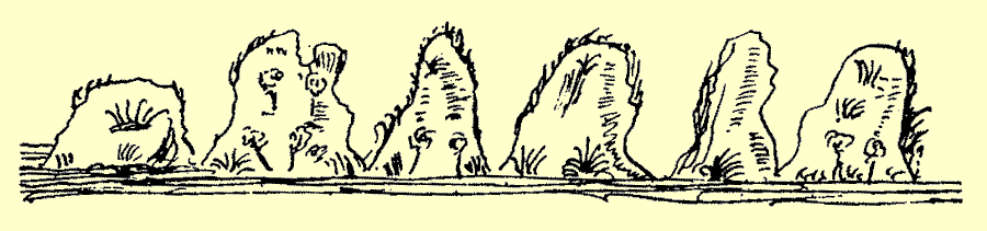
Cape of Udra. This is well known. Cape of San Ildefonso appears to be an island at a distance.
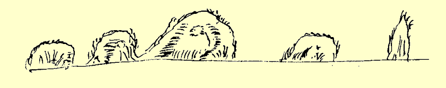
Tuesday the 12th of February was Shrove Tuesday. We dawned in the sea of Cape San Ildefonso, the wind W.N.W. Steering S.W. at night we were two leagues from the island of Diego Ramirez* which is S.W. of the Cape of San Ildefonso. We sounded in 50 to 55 fathoms, clean.
* Distant 57 miles from Cape Horn S.W. The highest part is 587 feet. Lat. 56° 31'S.
That night the wind was W.S.W. and we steered south under fore and mizen, intending to return to the island and anchor off it if it proved to be possible. On its south side there is another great rock. It presents the accompanying shape.
At this time there were strong gales every day, with furious squalls, much cold and snow.
On Wednesday the 13th of February the wind was W.N.W. obliging us to steer S.W. and preventing us from getting near the island, from which we were distant 15 leagues by dead reckoning. The altitude was not taken as there was no sun.
On Thursday the 14th of February the course was S.W. with the same weather. We made little way and there was no sun.
On Friday the 15th of February the course was W. b. S. with the wind N.N.W. and we made 10 or 12 leagues by dead reckoning. The altitude was not taken as there was no sun, the weather stormy and cold, the sea high.
On Saturday the 16th of February the wind as above, and the course west. We made about 15 leagues by dead reckoning, the current from W.N.W. The altitude was taken in 58° 30'.
On Sunday the 17th of February with the wind N. and N.N.W. we steered west and made 30 leagues by dead reckoning. The altitude taken in 58° 21'.
On Monday the 18th of February the wind was S.W. at dawn, and we steered N.W. until night when the wind came round to W. We made 20 leagues by dead reckoning. The altitude was not taken as there was no sun.
On Tuesday the 19th of February the course was N.W. b. N. and N.N.W. with wind N.E., and we made 15 leagues by dead reckoning. The altitude was taken in 56° 30'.
On Wednesday the 20th of February the wind had changed to north and N.N.W. with a cross sea. We fell off for 8 or 10 leagues. The sun was not visible, the weather stormy with snow.
On Thursday the 21st of February, at dawn, the wind was S.W. and S.S.W. afterwards W. and W.N.W. We steered many courses according to the direction of the wind. About 15 leagues N.N.E. made good. No sun. Weather cold with many showers.
On Friday the 22nd of February the wind being W.S.W. we steered N.N.W. and made 35 leagues by dead reckoning. No sun.
On Saturday the 23rd of February we steered north until noon, and took the altitude in 52° 52'. The wind S.W. After taking the altitude we steered east until nightfall and sighted the land. During the night we were under fore and mizen with a strong westerly wind, very cold with snow and showers.
On Sunday the 24th of February, at dawn, we found ourselves in bad weather, and unable to approach the land. We took the sun in 53°, and in the afternoon we sighted land again. As there was not time to reach it before dark we put it off for another day.
On Monday the 25th of February the weather was still bad, with many squalls, yet we resolved to approach the land, and if we could not make out the strait, to stand out to sea again. God was served that we should make out Cape Deseado* which is the entrance of the strait bearing E. b. N. Although we were doubtful, we approached nearer, and sighted the Four Evangelists† which are on the north side. When we had entered, we were satisfied that it was the strait. At the entrance there was a strong outward current. The westerly wind took us in, giving thanks to God for having shown us so many and such singular mercies. We anchored late in the afternoon, though it was still daylight, two leagues from Cape Deseado; that we might rest and take observations on the next day. For we were all very tired after the bad weather we had experienced since leaving the new strait.
* On the map it is called Sejada, evidently a misprint.
† Four rocky islets: the highest rises to 177 feet; 25 miles N.W. of Cape Deseado.
The cape on the south side, which we now call Cape Deseado is in 52° 45*, according to the altitude we took on the two previous days, when we sought to discover it.
* Quite correct.
The Cape Deseado and the adjoining coast to the south has 8 or 10 very lofty mountains covered with snow, and their peaks very easy to make out. These mountains, being very high, are visible from a great distance. The coast from Cape Deseado to the south, runs N.N.W. and S.S.E., as far as we could see when we entered the strait. The north side is not seen until one is well inside, though it is high land, but not so high on the south side. Thus, as we went on approaching the cape, the land opened out to us, and some large islands which are at the entrance of the strait. When inside, the Four Evangelists are discovered to seaward of the islands which are very high. Two of them are high, which appear first, the others are smaller, all of them like rocks.
In entering the strait Cape Deseado has to be approached having regard to what the weather will permit, it being only necessary to look out for the conditions around you. The Apostles* are near the coast which runs to the south and are placed so that, even if it be night, they can do no harm, as is shown on the plan. If you should enter by the middle of the strait, and the land is concealed by mist, as sometimes will happen, steer S.E. until it is clear or until it is daylight. If it is night, in approaching the south part of the coast, stand on until the land is seen, for as it is high it cannot fail to be made out. Unless the vessel is in some bay where the current has no effect, there will be no bottom. In some parts a vessel may be close to the land, and yet bottom will not be found for the anchor. The north side should not be approached because there are three or four mouths of great bays which might be mistaken for the channel. On the south side a vessel proceeds securely steering S.E. but the anchorage should be sought for in the daytime. Unless the channel is entered with plenty of time, it may be difficult to find an anchorage at night, but a vessel will not be in danger if she keeps under sail, for all the channel is safe and in soundings.
* Rocks 5 to 50 feet above the sea, with many breakers near them, the outer rock 4 miles from the land.
The north coast runs N.N.W. and the Four Evangelists are more than two thirds from Cape Deseado to the north, and project out to sea more than three leagues. It is easy to pass to the north of them. He who comes out of the strait on his way to the coast of Chile or Peru, must steer N.W. at least until he has passed the Evangelists, and then to the south. Here the winds are generally S.W., S.S.W. and W.S.W., and it is well to work to windward along the coast until a good offing is reached. The current gives much help, and at low water it rushes out westward like an arrow.
On Tuesday the 26th of February we set out for the cape in the boats, to take observations, but the bad weather obliged us to return, the wind S.W. and W.S.W., with many squalls and snow. In the afternoon we again went away in the boats to an island which we found in a bay where there were two landlocked harbours, unseen until we were in the boat. We found 28 to 30 fathoms, stony bottom, in the entrances to these harbours. One was at the cape, and the other was where it is marked, with all we were able to see. The tides appeared to be very variable and under no certain rule. This is so in many parts of Spain, how much more in localities so remote. When we left the caravels it was two in the afternoon, and it was half ebb. We returned at five and it was low water. According to the calculation of Spain, the moon on the 14th of February would be at its twelfth day, and ordinary rules make it high tide at 12.45, nearly an hour and a half difference.
The current, when the tide is rising, flows into the strait and when ebbing it flows out, to the west. Here we gathered a quantity of mogillones, and other shell fish, when it was low water, with which the men were refreshed.
On Wednesday the 27th of February we made sail at sunrise, after seeing and noting all that was necessary. We stood along the coast to S.E., all being harbour and very large bays which gave us satisfaction to see. Sailing until nightfall for 15 leagues more or less, we then anchored in 28 fathoms, so near the land that there was barely room to make sail. But the sea was quite calm, and no storms, the land being very high and the anchorage well sheltered from all winds.
On Thursday the last day of February we made sail in the morning, steering S.E. b. S. and S.E. with a good W.S.W. wind. At night we anchored in a bay, which we named San Joseph, being the middle of the strait.
March.
On Friday the 1st of March, at dawn, we entered a cove in this bay, which is like dead water, to clean, and grease, and get in wood and water, of which there was plenty. In the same morning we beached the caravels and, though we did not find much harm done, we greased them as well as we could.
On Saturday the 2nd of March we took in all the water we required, without attending to anything else, and always with our arms at hand ready for the savages, though we never saw any. We found the huts where they had been, and many shells of mogillones; of which there were quantities very large and good, with which to refresh the men.
On Sunday the 3rd of March we cut wood of which there was plenty near the sea shore. We got on board what we needed, and then at low water, which would be 9.30, always with arms ready, it was a wonderful sight to behold the quantity of shell fish we collected. Their excellence was in their size and good taste, and in their doing no harm, insomuch that we needed no other food. We went on collecting for several days, so that we had enough in pickle to last through Lent. God was served that the weather should clear so that we could take the altitude on shore. We found 47° on the astrolabe, the declination 6° 52', which together gave 53° 20'.
On the same day we made a calculation of the tides. According to the rule of Spain, if the February moon of this year was at the 14 day, then 14 to 28 makes another 14, and the 3 days of March added makes 17. According to the usual calculation this would give high water at 4.36 on the coast of Spain.* In this part we found that low water was at 10, and high water at 4.† These times agree with those of Spain.
* This calculation is quite correct.
† High water is at 4, at Port Churruca,§ near where the ships of the Nodals then were.
§ Presumably the editor (Clements Markham) identified the port by the name given to it in 1789. See footnote in Cunningham's Notes on the Natural History … for more details.
On Monday the 4th of March we got in the ballast required for the ships; and, after washing clothes, the people were refreshed.
On Tuesday the 5th of March we made sail at dawn, with the wind S.S.W. and S.W. being the usual winds in those parts, with much snow, and many squalls. We proceeded down the channel, steering S.E. b. E. and E.S.E., seeing on each side so many and such large bays that it was a sight to behold. We could not proceed a quarter of a league without coming to river mouths like those of Galicia,* many more on the south than on the north side.
* Arosa, Pontevedra, and Vigo, the deep bays of their native land of Galicia.
In the centre of the channel, for its whole length, no bottom can be found and in many places, even close to the shore, soundings are found with difficulty, and then only in the bays, and very near the land.
We arrived at the Bay of San Nicolas* and anchored in 18 fathoms. The bottom is clean, and in the middle of the bay there is an island† with three or four trees on it. We took soundings in the boats, finding 10, 12 to 15 fathoms clean. In the middle of the bay a very large valley is formed by a small river. At its mouth the boat grounded, but within there was more water. We went up it for a quarter of a league finding over a fathom of depth with a width equal to a stone's throw. This bay is to the east of the Cape of San Luis, and to the south of it are two rivers close to each other. At their mouth, to the southwest, there is a mountain with what appeared very like a small chapel on the summit.
* The best anchorage west of Cape Froward.
† Sanchez Island, now covered with trees.
On Wednesday the 6th of March we waited until noon to take the sun, but it was overclouded so that we could not see it. Meanwhile the boats went away to take soundings in other bays to the eastward, where we found very good ports for anchoring and for getting wood and water.
On Thursday the 7th of March we waited until noon, and it pleased God to give us the sun for taking the altitude. For it is fortunate to be able to do so, the usual winds from S.W, and S.S.W. blowing furiously with squalls, so that it is seldom that the sky is clear. We found 48° 30' on the astrolabe, declination 5° 19', which gave us 53° 49'.
We took the observation on shore, and then made sail, steering N. b. E. and N.N.E. At night we sought for anchorage on the coast, but the channel was very deep, and we got no bottom. We sent the boat towards the land, with a lantern and a musket to show a light and discharge the piece if they got soundings. In this way we were able to anchor in 26 or 30 fathoms. From thence to the eastward the land is level and suitable for cultivation, very pleasant and better than the land further west.
On Friday the 8th of March, at dawn, we made sail in such fine weather that we sent the boats away with nets. They caught few fish, and set fire to the forest in three or four places. There was a great quantity of sardines near the ships. The channel is wider here than in any other part, and as the land is low on both sides, the opposite shore is scarcely visible unless the weather is very clear. Here there appears an opening on the south side, coming from the east, which appears to communicate with the channel of San Sebastian.* At noon we took the altitude with the astrolabe in 48° 10', declination 4° 56', which together make 53° 6'. There was little wind, and it was late before we reached the Penguin Islands,† three in number, like the Berlings but more level on the summits. We sounded in 12 to 15 fathoms, but the other ship finding no bottom they made sail and eventually found 57 fathoms very near us. The bottom consisted of small pebbles, some of which came up on the armings. There was much mud and black clay on the anchor. The western side of the islands is the best anchorage as the current is not so strong. On the east side it is not so good, for though the bottom is much better the current is stronger.
* Useless Bay of modern charts.
† This is the Elizabeth Island of Drake: 7 miles S.W. of the second narrows, 8 miles long by 2 broad. See Drake's World encompassed, p. 75.
On Saturday the 9th of March, the day being fine, we went on shore at dawn. There was little wind and nearer the beach we found very good bottom in seven or eight fathoms, clear of the current. We came upon such quantities of the sea birds, called penguins, from which the island takes its name, that we filled the boat with them. These birds do not fly because they have no feathers on their wings, which are like those of a turtle. They only serve for moving in the sea. But they can run on shore almost like a man. The ground is covered with their holes. These birds are as big and fat as ducks, and I can certify with truth that, having weighed one, I found its weight to be 15 lbs. They skinned and salted these birds for the voyage, but did not eat any because it was Lent; though some partook of the livers boiled, and said they were very good. The penguins have a bad smell. There was a cask and a half of them in each ship. We went on board, and presently we made sail in fine weather, but with little wind, so that we were obliged to anchor again. We took the altitude between the two islands, 48° 10', the declination 4° 33', giving us 52° 43'.
On Sunday the l0th of March we made sail at dawn with the wind S.S.W., not able to stem the current which flowed in. The wind veered round to east, and we anchored before reaching the point of the second strait towards the north. We were between that cape and the Penguin isles, in 17 fathoms, small gravel and shells. It is not ground that can do harm.
On Monday the 11th of March we made sail before a W.S.W. to W.N.W. wind, proceeding along the channel with land in sight on both sides for a distance of four or five leagues between those two points bearing N.E. and W.S.W. We sailed out of the first narrow where a vessel enters it coming from the north sea, and then anchored on the south side, for in all the narrow part there are no soundings on either side, except very close to the land, until the point to the south is passed. Then there is a small bay with depths from seven or eight to ten fathoms. Passing that bay soundings will scarcely be found, and at night it is more difficult. For this reason it will be necessary for large ships to anchor in daylight, when between the narrow points. Within or outside them there is no such necessity. Though it was late, near sunset, we went on shore to ascertain the tides. We found that, entering the strait from the west, the water went down more than a fathom, while we were on shore. When we thought it should be high water according to our reckoning, we found that it was nearly low water as we knew from the experience of two days.
On Tuesday the 12th of March we went on shore with all the pilots. We then made our calculations and found that the water rose until five in the morning when it was high tide, the water flowing to the east, and that from five onwards the water ebbed, entering the strait from the west.
According to the reckoning of Spain it should be high water at 11.48. The moon of February was at 14 of that month, for 28 days in that month, or 14 and 12. We have for March 26 of the moon, taking 15 there remains 11 that have passed, of March. Then in conformity with ordinary rules, high water should be at 11.48.* We found all this difference in the narrowest part, near the entrance to the Strait of Magellan.
* It is high water full and change at 8.35 to the east of the first narrows, and at 9 in the narrows, with a rise at springs of 36 to 44 feet. At the other (west end) of the strait only 4 feet at springs, high water 1.32.
Having made these observations, and ascertained what there was to know, we made sail with the wind S.W., and clear fine weather, proceeding up the north side of the channel. When we made sail we saw two or three natives. One of them got on a hillock, making signs with a skin or blanket he was carrying, and we saw that he was calling us. We sent the pilot Juan Nuñez away in a boat with arms, to go within hearing distance. If the native spoke so as to be understood, and wanted to come on board, he was to be brought. For we had the suspicion that he might possibly be a castaway from the ship that we had found wrecked near the Cape of Virgins, or from some other. For we once found such an one in the power of the Indians in Dominica in the year 1605 when we went with Don Luis Faxardo to Salinas de Araya with orders not to land. The boat came near the beach and found 20 natives with peaceful intent, naked to the skin, and like those we met in the new strait. They opened their arms, and jumped in sign of content and joy, asking those in the boat by signs to come on shore.
As I did not relate, when we were in the new strait, the incident of the first days when we had intercourse with the natives, I will now write it down as very necessary for the completeness of the history. As we could not understand each other, the priests who came in our company, exercising their office as such, spoke and proposed the most sweet names of Jesus and Mary, and the prayer, Our Father, which Christ taught to his disciples. The natives seeking [sic, seeing] what our people wanted, repeated the same words, some with more gentleness, others with more asperity. In the following days they came skipping and jumping as was their wont and repeating the words Jesus and Maria, some of them duplicating the r in Maria, showing that they took pleasure in doing so. It seemed wonderful to us to hear these barbarians repeating so delicately the sovereign and divine names of our Lord and our Lady. As the pilot Juan Nuñez saw that the natives did not understand him he returned on board.
Proceeding on our voyage, and crossing the channel, we entered a bay on the north side, one or two leagues beyond the narrow part. On the beach there were three rocks which appeared to be surrounded by the sea, from the ships, but from the mast head we could see that they were on the beach.
On the south side, further east than where we anchored, there is another low point where there is a bank of sea weed, which should have a wide berth, for the boat was sent away to sound under sail, and found 4, 5 to 6 fathoms over the sea weed. But it is not very far from the beach, and ships cannot go so near. If they are working to windward the weed is presently sighted over the water. After passing it there are 15 to 18 fathoms, and then mid channel is reached, where there is great depth.
Proceeding past this bay towards the Cape of Virgins, we passed along the coast, sounding in from 25 and 20 to 15 fathoms, clean bottom. In passing out of the strait at night or in thick weather, a vessel should not stand in to sight land, but steer east or N.E. b. E. to clear the cape and beach which project to the S.E. of the Cape of Virgins, and always with the lead in hand. If it is clear this will not be necessary as everything is in sight on either side. We came to off the Cape of Virgins in the same place where we anchored when we arrived on the outward voyage.
It should be noted, that in passing the Cape of Virgins to enter the Strait of Magellan, the entrance should be on the north side if there is a fair wind, which is rarely the case so far as we have seen, for the winds are usually from S.W., W.S.W., west or W.N.W., which are all contrary and come over the land. They blow out of the strait with such force that there is no facing them, and this is the reason that this strait is so difficult to enter. To pass to the south it is necessary to navigate with the lead in hand, steering always by the plan that the pilot has with him, and which is given in this book.
At dawn on the 13th of March, being Wednesday, we went on shore with the object of again observing the tides which we found to be in conformity with our observations the day before, and also to take the altitude. In landing the boat was swamped and we were all thrown into the water, for the sea was very rough with a south wind which blew hard for some time. Those who were in the capitana's boat, having seen what happened to us, came to the shore and were swamped in the same way. We were thus left without the means of returning on board. But God was served that the wind should go down, so that we were able to right the boats and return on board, with much difficulty, before noon. We took the sun on board, with the astrolabe 49° 25', declination 2° 59', which together gave 52° 24'* in which latitude the Cape of Virgins may be placed. On the beach we found traces of natives, and of beasts with split hoofs, and of dogs. The natives lit a fire with much smoke on the hill top which presently went out. We returned to get some iron nails from the wreck which we found on the outward voyage.
* 52° 18'.
Fourth Voyage from the Cape of Virgins To Brazil, Port of Pernambuco.
On Wednesday the 13th of March, after having taken the sun, we made sail before a fair west and N.W. wind, and as soon as we were 4 to 6 leagues from the Cape of Virgins we steered N.N.E.
• • • • •
Fifth and Last Voyage from Pernambuco to the Bar of San Lucar de Barrameda.
On Tuesday the 14th of May we left the port of Pernambuco on our return to Spain, with a S.E. wind, steering N.N.E., in company with the fleet that assembled here, and made 15 leagues by dead reckoning.
• • • • •
On Tuesday the 9th of July [1619] at noon we entered the bay of San Lucar de Barrameda with the caravels, where the voyage was ended, thanks to God, to the Virgin of Atocha and to the Virgin of Buen-Suceso.
laus deo.