

Coordinates recorded by Alexander Usborne on the Constitucion after departure of HMS Beagle.
| Place Name | Lat. South | Long. West |
Ahuja Point  —western cliff summit —western cliff summit | 05° 55' 30" | 81° 10' 00" |
| Algodon Bay —extremity of point | 22° 06' 00" | 70° 17' 05" |
| Arica —Mole | 18° 28' 05" | 70° 23' 45" |
| Arica —summit of Monte Gordo | 18° 28' 55" | 70° 23' 30" |
| Asia Rock —summit | 12° 48' 00" | 76° 41' 55" |
| Atico —east cove | 16° 13' 30" | 73° 45' 15" |
| Beware Point —south-west extreme | 15° 08' 35" | 75° 25' 45" |
| Blanco, Cape —under middle high cliff | 04° 16' 40" | 81° 15' 45" |
| Callao Bay —Arsenal Flagstaff | 12° 04' 00"2 | 77° 13' 30" |
| Carrasco, Mount —highest summit | 20° 58' 30" | 70° 09' 45" |
| Carreta, Mount —summit | 14° 09' 50" | 76° 20' 20" |
| Casma Bay —inner south point | 09° 28' 00" | 78° 25' 35" |
| Chala Point —extreme | 15° 48' 00" | 74° 31' 00" |
| Chancay Head —summit | 11° 35' 55" | 77° 20' 35" |
| Chao Islet —centre | 08° 46' 30" | 78° 49' 00" |
| Chilca Cove —Rock—summit | 12° 29' 20" | 76° 52' 30" |
| Chilca Point —south-west pitch | 12° 31' 00" | 76° 52' 40" |
| Chipana Bay —O.S. | 21° 23' 00" | 70° 10' 50" |
| Chorillos [sic, Chorrillos] Bay (no coordinates given, modern source inserted) | 10° 46' 00" | 77° 46' 00" |
| Cobija —flagstaff—landing-place | 22° 34' 00" | 70° 21' 05" |
| Coles Point —extremity | 17° 42' 00" | 71° 26' 15" |
| Colina Redonda —summit | 09° 38' 35" | 78° 24' 20" |
| Constitución Cove —shingle point on island | 23° 26' 42" | 70° 40' 30" |
| Doña Maria —Table—central summit | 14° 41' 00" | 75° 53' 40" |
| Eten Head —summit over | 06° 56' 40" | 79° 53' 50" |
| Ferrol Bay —Blanco Island—summit | 09° 06' 30" | 78° 39' 25" |
| Frayles Point —extreme | 13° 01' 00" | 76° 34' 50" |
| George, Mount —Morro Jorge—summit | 23° 15' 10" | 70° 39' 45" |
| Gorda Point —western low extreme | 19° 19' 00" | 70° 21' 30" |
| Guañape Islands —summit of highest | 08° 34' 50" | 78° 59' 15" |
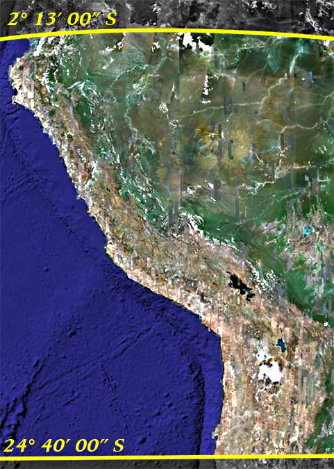
| Guayaquil —south end of city | 02° 13' 00" | 79° 53' 30" |
| Hormigas Islet —largest (southern) | 11° 58' 00" | 77° 50' 00" |
| Huacho Point —extreme pitch | 11° 08' 45" | 77° 40' 15" |
| Huanchaco Point —south-west extremity | 08° 05' 40" | 79° 09' 00" |
| Huarmey —west end of sandy beach | 10° 06' 15" | 78° 13' 00" |
| Iquique —centre of island | 20° 12' 30" | 70° 14' 30" |
| Islay, Mount —summit | 16° 56' 05" | 72° 08' 30" |
| Islay —Custom House | 17° 00' 00" | 72° 10' 15" |
| Jaguay, or Gramadel, Head —west extremity | 10° 25' 15" | 78° 03' 30" |
| Jara Pont —summit | 23° 53' 00" | 70° 35' 45" |
| Jaron, Mount —summit | 23° 52' 30" | 70° 32' 15" |
| Lambayeque —beach opposite | 06° 46' 00" | 79° 59' 30" |
| Loa, Rio —mouth of | 21° 28' 00" | 70° 06' 15" |
| Lobo Point, or Blanca —outer pitch | 21° 05' 30" | 70° 15' 45" |
| Lobo Point —summit | 18° 45' 40" | 70° 25' 30" |
| Lobos de Afuera Island —Fishing Cove on east side | 06° 56' 45" | 80° 43' 55" |
| Lobos de Tierra —central summit | 06° 26' 45" | 80° 52' 50" |
| Lobos Island —near Payta—south extreme | 05° 13' 35" | 81° 13' 10" |
| Lomas —flagstaff on Point | 15° 33' 15" | 74° 54' 45" |
| Macabi Islet —summit | 07° 49' 15" | 79° 30' 55" |
| Malabrigo Bay —rocks | 07° 42' 40" | 79° 28' 00" |
| Malpelo Point —mouth of Tumbes River | 03° 30' 40" | 80° 30' 30" |
| Mexillones Hill —summit | 23° 06' 30" | 70° 35' 00" |
| Mollendo | 17° 00' 00" | 71° 00' 00" |
| Mongon, Mount —western summit | 09° 38' 15" | 78° 21' 15" |
| Moreno, Mount —summit | 23° 28' 30" | 70° 38' 15" |
| Morro Solar —summit | 12° 11' 30" | 77° 06' 15" |
| Nasca Point —summit | 14° 57' 00" | 75° 34' 30" |
| Pacasmayo Point —north-west extreme | 07° 25' 15" | 79° 37' 25" |
| Paraca Bay —west point—north extreme | 13° 48' 00" | 76° 22' 15" |
| Pariña Point —extreme | 04° 40' 50" | 81° 20' 45" |
| Patache Point —extreme | 20° 51' 05" | 70° 18' 15" |
| Payta —new end of town | 05° 05' 30" | 81° 08' 15" |
| Payta —Silla (or Saddle)—south summit | 05° 12' 00" | 81° 09' 20" |
| Pelado Islet —summit | 11° 27' 10" | 77° 53' 00" |
| Pescador Islands —summit of largest | 11° 47' 10" | 77° 19' 50" |
| Pescadores Point —south-west extreme | 16° 23' 50" | 73° 20' 25" |
| Pica Pabellon —summit | 20° 57' 40" | 70° 14' 00" |
| Picos Point —extreme cliff | 03° 45' 10" | 80° 47' 30" |
| Pisagua —Point Pichalo—extreme | 19° 36' 30" | 70° 19' 00" |
| Pisco —Town—middle | 13° 43' 00" | 76° 16' 30" |
| Puná Island —Consulate on Point Española | 02° 47' 30" | 79° 57' 45" |
| Quilca —Cove—west head | 16° 42' 20" | 72° 31' 00" |
| Reyes Head —extreme pitch | 24° 34' 30" | 70° 39' 45" |
| Salinas Hill —summit | 11° 15' 30" | 77° 39' 55" |
| Sama, Mount —highest summit | 17° 58' 35" | 70° 56' 15" |
| Samanco Bay —Cross Point | 09° 15' 30" | 78° 32' 45" |
| San Francisco Head —west pitch | 21° 55' 50" | 70° 14' 45" |
| San Gallan —Island—northern summit | 13° 50' 00" | 76° 31' 15" |
| San Juan —Needle Hummock | 15° 20' 56" | 75° 13' 20" |
| San Lorenzo Island —north point | 12° 04' 00"1 | 77° 19' 00" |
| San Nicholas Bay (no coordinates given, modern source inserted) | 15° 15' 39" | 75° 13' 47" |
| Sana Point —extreme | 07° 10' 35" | 79° 43' 30" |
| Santa —centre of projecting point | 09° 00' 00" | 78° 41' 30" |
| Sechura Town —church | 05° 35' 00" | 80° 49' 45" |
| Supé —west end of village | 10° 49' 45" | 77° 47' 00" |
| Tambo Valley —Point Mexico—south-west extreme | 17° 10' 50" | 71° 52' 00" |
| Trigo, Mount —summit | 24° 40' 00" | 70° 36' 15" |
| Truxillo —church | 08° 07' 30" | 79° 04' 00" |
| Wickham, Mount —summit | 08° 20' 00" | 78° 49' 00" |
| Wilson, Mount —summit | 14° 04' 50" | 76° 20' 15" |
| Ylo Town —rivulet mouth | 17° 37' 00" | 71° 23' 45" |
| Yndependencia Bay —south point of Santa Rosa Island | 14° 18' 15" | 76° 13' 30" |