Xavier Island  —Ignacio Beach —Ignacio Beach | 47° 10' 00" | 74° 25' 40" |
| Jesuit Sound —central mount | 47° 09' 30" | 74° 08' 20" |
| Xavier Island —Lindsay Point—north-east extremity [after deceased Serjeant on first voyage] | 47° 03' 15" | 74° 16' 00" |
| Kelly Harbour —south point extreme | 46° 59' 30" | 74° 08' 30" |
| Kelly Harbour —north point extreme | 46° 59' 00" | 74° 05' 50" |
| Tres Montes , Cape —extremity | 46° 58' 57" | 75° 27' 50" |
| Tres Montes , Cape —summit over | 46° 57' 50" | 75° 27' 55" |
| Purcell Island —summit | 46° 55' 20" | 74° 39' 45" |
| Cirujano Islet —north-east point | 46° 51' 10" | 74° 21' 45" |
| Forelius Peninsula —Isthmus (narrowest part) | 46° 50' 00" | 74° 41' 40" |
| Otway, Port —Observation Spot | 46° 49' 31" | 75° 19' 20" |
| Otway, Port —summit over southern entrance head | 46° 49' 30" | 75° 18' 00" |
| Raper, Cape —rock close to | 46° 49' 10" | 75° 40' 55" |
| Bad Bay —summit west of | 46° 47' 10" | 74° 51' 40" |
| Rees Point —extreme | 46° 44' 40" | 75° 42' 20" |
| Sugar Loaf —summit | 46° 42' 40" | 75° 15' 00" |
| Mitford Head —summit | 46° 39' 00" | 75° 40' 30" |
| St. Paul's Dome —summit | 46° 36' 16" | 75° 13' 40" |
| Gallegos, Cape —Small Islet near | 46° 35' 40" | 75° 40' 00" |
| Gallegos, Cape —summit | 46° 35' 00" | 75° 28' 30" |
| Christmas Cove —O.S.—at south-east extremity of cove | 46° 35' 00" | 75° 34' 05" |
| Cone —summit | 46° 34' 10" | 75° 31' 00" |
| Pringle Point —extremity | 46° 30' 50" | 75° 33' 00" |
| Rescue Point —summit—northern [the modern Puerto San Esteban] | 46° 18' 10" | 75° 13' 45" |
| Hellyer Rocks —middle | 46° 04' 00" | 75° 14' 00" |
| Taytao, Cape —western extreme | 45° 53' 20" | 75° 08' 00" |
| Skyring Monument —summit | 45° 53' 10" | 75° 04' 00" |
| Gallegos, Mount —summit | 45° 52' 45" | 74° 56' 45" |
| Patch Cove —O.S.—under Mount Gallegos | 45° 52' 15" | 74° 55' 50" |
| Refuge, Port —Puentes Island—summit | 45° 51' 36" | 74° 51' 25" |
| Inche Island —south-east summit | 45° 48' 05" | 75° 01' 00" |
| Anna Pink Bay —St. Julian Island—summit | 45° 47' 25" | 74° 55' 00" |
| Haddinton, Mount —summit | 45° 43' 25" | 74° 39' 50" |
| Mensuan Island —summit | 45° 36' 00" | 74° 56' 00" |
| Riviero, Mount —summit | 45° 34' 45" | 74° 35' 00" |
| Midbay Rock —centre | 45° 27' 30" | 74° 45' 00" |
| Garrido, Cape —northern extreme | 45° 26' 10" | 74° 32' 20" |
| Darwin Channel —north-east head | 45° 25' 00" | 74° 25' 00" |
| Isquiliac, Mount —summit | 45° 20' 00" | 74° 21' 40" |
| Vallenar Road —O.S.—south-east extreme of Three-finger Island | 45° 18' 30" | 74° 36' 15" |
| Lemu Island —summit | 45° 12' 10" | 74° 34' 15" |
| Paz Island —summit | 44° 57' 00" | 74° 40' 45" |
| Huamblin (or Socorro) Island —south extreme | 44° 55' 50" | 75° 12' 45" |
| Huamblin (or Socorro) Island —west head | 44° 49' 30" | 75° 14' 45" |
| Ypun (or Narborough) Island —John Point—extremity | 44° 40' 40" | 74° 48' 30" |
| Stokes Island —summit | 44° 40' 30" | 74° 33' 10" |
| Lort, Cape —summit over | 44° 32' 35" | 74° 50' 20" |
| Hulk Rocks —northern—above water | 44° 16' 00" | 74° 33' 00" |
| Main, Mount —summit | 44° 09' 00" | 74° 11' 45" |
| Mellersh Island —western extremity | 44° 04' 45" | 74° 23' 50" |
| Melimoyu Mountain —summit | 44° 01' 30" | 73° 07' 00" |
| Tuamapu Island —summit | 43° 58' 30" | 74° 15' 20" |
| Huaytecas Island —central summit | 43° 52' 45" | 74° 01' 00" |
| Huayhuin Point —western islet off | 43° 51' 00" | 74° 13' 00" |
| Low, Port —O.S. on rocky islet in harbour | 43° 48' 30" | 74° 03' 05" |
| Chaylime Point —north extremity | 43° 46' 10" | 73° 55' 40" |
| Huacanec Islets —northernmost—small | 43° 46' 05" | 74° 03' 30" |
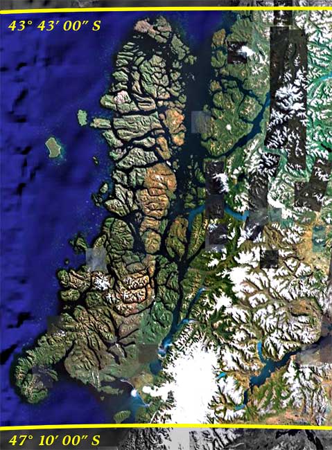
| Queytao Islet —largest—summit | 43° 43' 00" | 73° 35' 30" |